

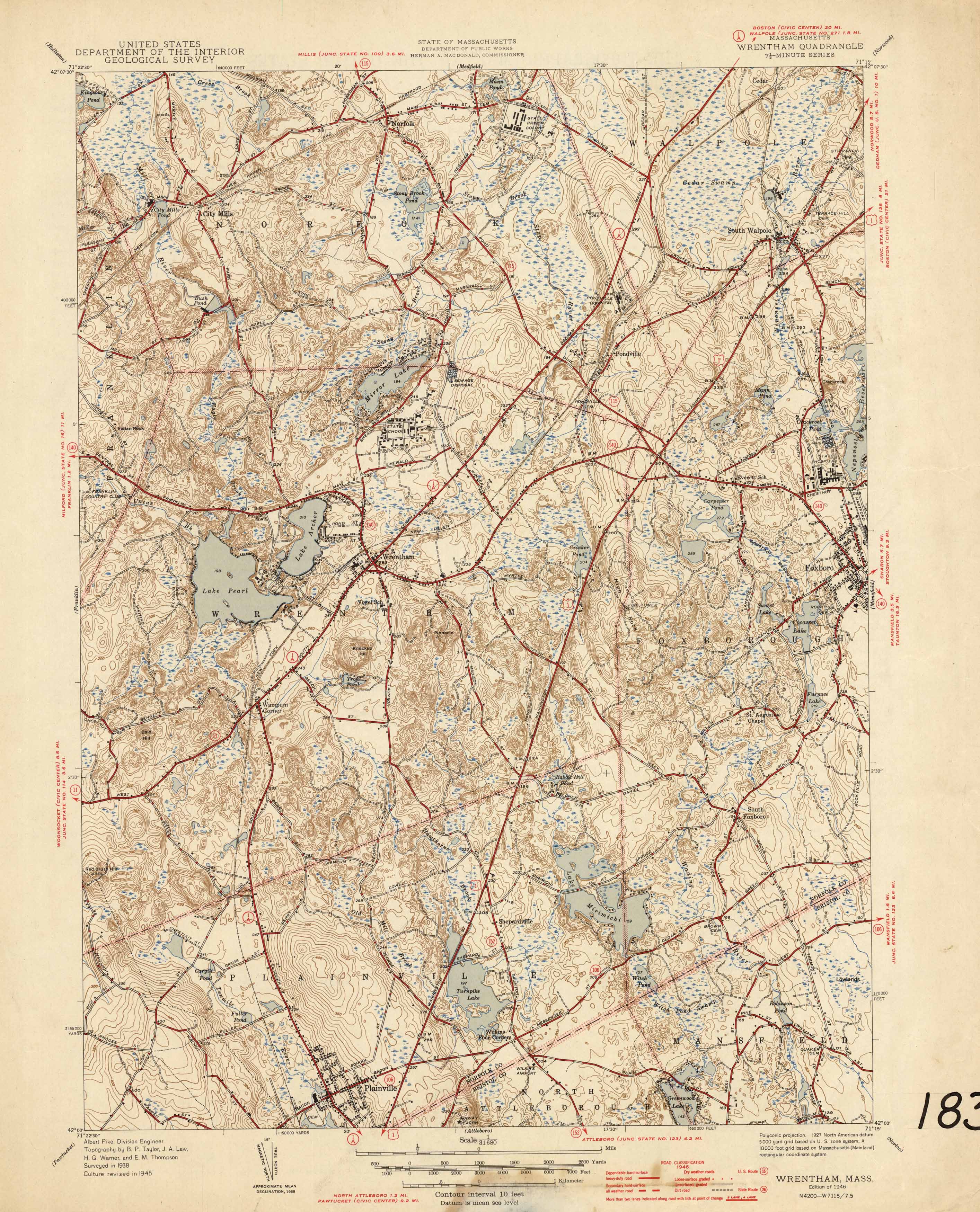

Antique Pittsfield West, Massachusetts 1947 US Geological Survey Topographic Map – discount Richmond, Lenox, Lanesboro, Hancock, Berkshire County, MA
Beautiful, antique map of Pittsfield and surrounding Berkshire County area in Western Massachusetts. This is an authentic edition of 1947 print from the U.S. Geological Survey and NOT a computer reproduction.
See what Massachusetts looked like 75 years ago. Lots of intricate details and geological contours. Map even has little squares for every house that existed at the time. The USGS cartographers were very thorough back then! On the back is a description of topographic symbols and map guide.
Perfect for the historian, map-lover, the curious or just as a conversation starter. Wonderful and rare. Vintage maps such as these make great gifts.
Edition of 1947, printed 1947
Dimensions: 17" width x 21" height
----
Features
Cities & Towns: MASSACHUSETTS: Pittsfield, Lanesboro, Richmond, Lenox, Hancock, West Pittsfield, Stevens Corner, Barkerville, Shaker Village.
NEW YORK: New Lebanon, Lebanon Springs.
Points of Interest: Onota Lake, Pontoosuc Lake, Richmond Pond, Morewood Lake, Housatonic River, Pittsfield Airport, Wahconah Park, Taconic Range, Pine Mountain, Doll Mountain, Shaker Mountain, Mt. Lebanon, South Mountain, Mahanna Cobble, The Cobble, Yokun Seat, Lenox Mountain, Pleasant Valley, Boston & Albany Railroad, and more roads, railroads, houses, ponds, hills, mountains, valleys, marshes, and streams.
Condition: Very Good Vintage condition, commensurate with age. This map is in great shape for being over discount 70 years old. Has light wear but this will add to vintage character when framed.
----
We will happily adjust shipping price for multiple purchases. Maps are rolled up and shipped in sturdy mailing tubes, never folded.